Biking
Massachusetts has plenty of bike trails and bicycling rentals in town and country
Start pedaling and you’ll discover that Massachusetts is bike friendly for all ages and abilities. In country or in town you can travel former railroad and trolley tracks, riverbeds and shoreline, parks and greenways. There are paved roads, car-free service roads and off-road trails. Bike through historic and indescribably scenic places, on flat and hilly terrain, on marked and handicap accessible stretches. You’ll find comfort stations and concession stands, bike rentals, parking, and access to public transportation. Stay in a cozy B&B or relax at a nearby spa after a day out. Ahhhh!
22 listings
Martha's Vineyard, MA
Biking Trails on Martha’s Vineyard
see map linkBiking trails are plentiful all over Martha’s Vineyard, as are bike rental and repair shops. Here’s a nice bonus: if you travel farther than your legs can carry you (back home) you can easily pop your bike on the buses of the Vineyard Transit Authority, which serves all of the island. To choose a bike route, see this downloadable Bike Trail Map.
towns of Martha's Vineyard, MA
Eight Bike Trails on Martha’s Vineyard
see descriptionThis biking guided, including short descriptions of eight trails and a trail map, is provided by the Martha’s Vineyard commission.
West Chop: In Vineyard Haven, take Main Street past the West Chop Lighthouse and return on Main or Franklin streets. 4 miles.
East Chop: The water route between Vineyard Haven and Oak Bluffs has a lot of traffic. Take care around Martha’s Vineyard Hospital. 3 miles.
Oak Bluffs to Edgartown: This Beach Road route from Oak Bluffs to Edgartown is well-loved by bicyclists. You will have beautiful views of State Beach and Sengekontacket Pond. The path is narrow and sandy. 6 miles.
Edgartown to Vineyard Haven: Along Edgartown-Vineyard Haven Road. 7 miles.
Edgartown to South Beach: Flat and pleasant ride. Take a side trip along paths (equipped with bike racks) on Katama and Herring Creek roads. 7 miles.
State Forest Rides: The bike path that parallels Edgartown-West Tisbury Road enters the State Forest, a 10-mile loop. A shorter loop (3 miles) is in the northeast part of the forest. Both of these loops are accessible from Oak Bluffs and Vineyard Haven.
Up-Island: The towns of West Tisbury, Chilmark, and Aquinnah do not have shared use paths. Roads are winding and hilly. Best for the more-skilled bikers.
West Tisbury to Vineyard Haven: A handy detour is the rolling, twisty Lambert’s Cove Road, to West Spring Street.
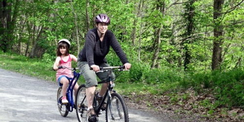
West Boylston to Holden, MA
Massachusetts Central Rail Trail
see trail mapMassachusetts Central Rail Trail for bicycles and walkers, when finished, will include 104 miles connecting 24 communities Boston to Northampton. Various groups are refurbishing the trail in pieces. Volunteers with Wachusetts Greenways have opened 11 miles of the rail trail, as follows Sterling from Cider Mill to Gates Road; West Boylston/Holden from Oakdale to River Street along the Quinapoxet River; Holden Connector from River Street to Manning Street to Mill Street; Rutland from Wachusett Street south to the Holden line; Rutland from Glenwood Road to Route 56; Rutland from the Charnock Hill Road to Barrack Hill Road to Rutland State Park entrance road to Route 122 and the Midstate Trail. Get out on two wheels to two feet and join the adventure. - Rail Trail Map
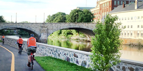
South Worcester, MA
Blackstone River Greenway in Massachusetts
McKeon Road in South Worcester, MA, to Tockwotton Park in Providence, RILength: 26.6 miles
The goal of developers is to create a 50-mile network of trails along the historic Blackstone River's banks from Worcester, MA, to Providence, RI. Completed off-road sections in Massachusetts include a 3.5-mile segment from South Worcester to Millbury, and a 3.6-mile trail in Blackstone River and Canal Heritage State Park in Uxbridge. - Trail Map for the Park.
Currently, the longest off-road segment connects Woonsocket and Pawtucket in Rhode Island. Learn about the Blackstone River Greenway and Bikeway, with maps. Uses include biking, skating, fishing, horseback riding, walking and cross country skiing. The trail is wheelchair accessible.
Parking and Trail Access Points:
In Worcester: Parking at the Blackstone Heritage Corridor Visitor Center off McKeon Road in Worcester. - Map
Blackstone River and Canal Heritage State Park in Uxbridge: Parking is at the River Bend Farm Visitor Center at 287 Oak St, Uxbridge. - Map
Woonsocket: Rivers Edge parking Area on Davison Avenue in Woonsocket. - Map
Lonsdale: Parking area and trail access point near the Pratt Dam in Lonsdale on RI Route 123/Front Street. - Map
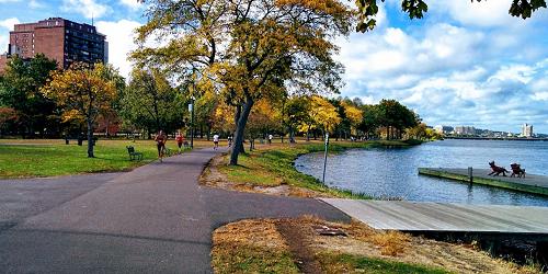
Boston, MA
Charles River Bike Paths in the Charles River Reservation
617-626-1250Total Length: about 18 miles
This 14-mile loop follows both banks of the Charles River from the Museum of Science in Boston to Watertown Square in Watertown. The quality varies from 12 feet wide with center stripes to 4 feet wide with 6-inch drops at the edges. In some places it is barely wide enough for one bicycle to pass another; in others, there are separate bicycle and pedestrian paths. The path can be entered at any point on the Cambridge and Watertown sides, from all but the Longfellow and Boston University bridges on the Boston side, and from footbridges over Storrow Drive. The Urban Parks Division of the Massachusetts Department of Conservation and Recreation (DCR) manages and maintains this path.
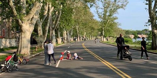
Cambridge, MA
Riverbend Park
Memorial DriveTotal length: 1 mile
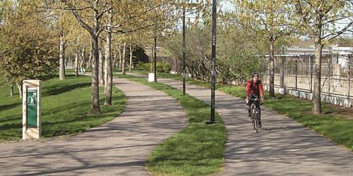
Riverbend is not a park, but rather the informal name for a one-mile stretch of Memorial Drive in Cambridge from the Eliot Bridge to Western Avenue that is closed to vehicle traffic on Saturdays and Sundays from 8am - 7pm from late April to late November.
Back Bay in Boston to Roxbury and Jamaica Plain, MA
Southwest Corridor Park
Along the Orange Line of the MBTA 617-727-0057Total length: 6 miles
The Southwest Corridor Park is a 4.7 mile, 52-acre, linear park stretching from the Back Bay to Forest Hills. It links the neighborhoods of South End, Back Bay, Roxbury and Jamaica Plain with a street-level, green open space for parkland and recreation. Approximately a quarter of the parkland is decked over the railroad tracks. Adjacent Streets, starting from the Boston Back Bay T station, include Carleton Street, Columbus Avenue, Tremont Street, Centre Street, Lamartine Street, Amory Street. Adjacent to Arnold Arboretum at the southern end.
Boston, MA
Emerald Necklace Parks
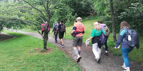
617-522-2700This is a series of links between parks from the Public Garden to Franklin Park, also passing through Back Bay Fens, Riverway, Olmsted Park, Riverway, and Arnold Arboretum. - Trail Map
HIngham, MA
Bike Trail at Wompatuck State Park
Union Street 781-749-7160Total Length: 12 Miles
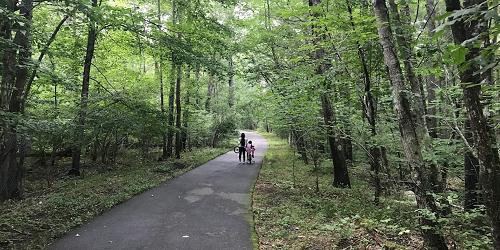
Wompatuck State Park is named for a 17th century Indian Chief whom the colonists knew as Josiah Wompatuck, and was later used by the U.S. military during World War II as an ammunition depot. Bicyclists who venture to Wompatuck State Park will find 12 miles of paved bike trails flanked by a peaceful wooded campground. One of the park’s main attractions is Mt. Blue Spring, a natural source of fresh drinking water to which visitors can help themselves at no cost. - Trail Map (PDF)
Ayer, Groton, Pepperell and Dunstable, MA
Nashua River Rail Trail
978-597-8802Total length: 11 Miles
In 1848, the Worcester & Nashua Railroad opened for business with over 46 miles of track between Worcester and Nashua, New Hampshire. In 1982 the route was shut down for good, and it would be 20 more years until the Mass Highway Department completed what today is the Nashua River Rail Trail, built on the railroad’s former path, stretching 11 miles through the towns of Ayer, Groton, Pepperell and Dunstable. The trail offers a 10-foot wide paved surface for the entire length, and is open to pedestrians, bicyclists, inline skaters, wheelchairs, and cross-country skiers. The trail is popular for it’s scenic overlooks, impressive foliage in the fall, and for its access to commuter rail service between Boston and Fitchburg.
Hudson, Marlborough, MA
Assabet River Rail Trail
978-562-2989Trail Length: 5.6 miles
The Assabet River Rail Trail flanks the scenic Assabet River for 5.6 miles (with plans to expand to 12 miles in the future) through the towns of Hudson and Marlborough. This 12-foot wide, paved trail is great for bicyclists who want a forested, scenic ride, with minimal traffic crossings. The trail crosses over the river several times, at one point over an historical, wrought iron railroad bridge. Cyclists can pick up the trail in Hudson along Route 62, where a restored 1921 blue caboose marks the trailhead parking area. Other trail parking areas are: 157 Washington Street at Rite Aid Pharmacy in Hudson; 417 Main Street in Hudson; 40 Hudson Street in Marlborough. - Trail Map
Lowell, Chelmsford, and Westford, MA
The Bruce Freeman Trail
Total Length: 6.8 miles
The first phase of this proposed 25-mile rail trail is a 6.8 mile stretch connecting the towns of Lowell, Chelmsford, and Westford. When finished, the rest of the trail will link Carlisle, Acton, and Concord -- following the 25-mile route of the old New Haven Railroad Framingham & Lowell line. - Trail Map
Lanesborough, Cheshire, Adams, MA
Ashuwillticook Rail Trail
413-442-8928Total Length: 11.2 Miles
The Ashuwillticook Rail Trail is a former railroad corridor converted into a 10-foot wide paved, universally accessible, passive recreation path. The trail runs parallel to Route 8 through the towns of Cheshire, Lanesborough and Adams, with the southern end of the rail trail beginning at the entrance to the Berkshire Mall off MA Rte. 8. and ending 11.2 miles north at the center of Adams. Cheshire Reservoir, the Hoosic River, and associated wetlands flank much of the trail offering outstanding views of the scenery and abundant wildlife. Parking lots and restrooms are available at selected locations along the way. - Trail Map
Falmouth, Woods Hole, MA
Falmouth Shining Sea Trail
508-548-7611Total Length: 10.7 miles
Starting just outside Falmouth Center, the Falmouth Shining Sea Trail provides a fairly level ride on paved bike path between Falmouth and Woods Hole. The trail boasts some beautiful scenery, running through extensive salt marsh, cranberry bogs, and farmland, with beautiful ocean views. Access to the trail can be found on Locust Road in Falmouth. - Trail Map
Bourne, Sagamore, MA
Cape Cod Canal Bikeway
Total Length: 7 Miles
The service roads which parallel both sides of the Cape Cod Canal, partially maintained by the Army Corps of Engineers, make for great scenic bicycling. Each service road is approximately 7 miles long, with parking areas, comfort stations and picnic areas provided at various access points along both sides of the Canal. The trail is relatively level, making it ideal for children and families. See map for access locations.
Eastham, Truro, Provincetown, MA
Cape Cod National Seashore Bike Trails
508-771-2144Total Length: 1.6 miles, 2 miles, and 5.45 miles, respectively
The Cape Cod National Seashore maintains three bicycle trails ranging from 1.6 to 7.3 miles long. Use of motorized vehicles, including mopeds, on these paved trails is prohibited. Bicycles may be rented within the towns.
Nauset Trail in Eastham connects Salt Pond with Coast Guard Beach. (1.6 miles).
Head of the Meadow Trail in Truro skirts a freshwater marsh and provides glimpses of the marsh and dunes. From High Head Road in Truro to Head of the Meadow Beach (2 miles).
Province Lands Trail in Provincetown winds among beech and oak forests, sand dunes and freshwater ponds. - Trail Map
Chelsea, Medford, & Somerville, MA
Mystic River Reservation
617-727-5380Series of parks and green spaces along Mystic River; accessible by MBTA trains; walking, biking, picnicking, swimming
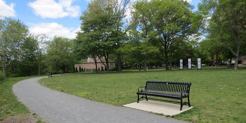
The Mystic River Reservation is a string of parks and greenways along the Mystic River. It includes lots of trails for biking and walking. Accessible from Boston and Cambridge by MBTA commuter trails.
Dennis, Harwich, Brewster, Orleans, Eastham, and Wellfleet, MA
Cape Cod Rail Trail
508-896-3491Total length: 22 miles
The Cape Cod Rail Trail follows a former railroad bed for 22 miles through Dennis, Harwich, Brewster, Orleans, Eastham and Wellfleet. Its paved surface, few hills, and well-marked road crossings make it ideal for cyclists. The trail has a wide unpaved shoulder on one side to accommodate horseback riding, walkers, and runners.
There are many places to get off the trail and visit a beach. Food and water are available and restrooms can be found at Nickerson State Park, Salt Pond Visitors Center at Cape Cod National Seashore, and the National Seashore Headquarters. Bike rentals are available at many points . A limited number of hand-cycles are available for rent at some bike concessions. See trail website for list of free parking areas. Trail Map
Northampton, Hadley, & Amherst, MA
Norwottuck Rail Trail
Begins at Elwell State Park, Damon Road 413-586-8706Total Length: 11 Miles
The Norwottock Rail Trail is an 11 mile path linking Northampton, Hadley, and Amherst along the former Boston & Main Railroad, built in 1887. The path's level terrain provides safe passage for bicyclists of all ages and abilities and both ends of the path offer free parking for trail users – Elwell State Park on Damon Road in Northampton and Station Road in South Amherst. Historians believe that the Native Americans who lived here before the European settlers were called the Norwottucks. Translated, norwottuck means “in the midst of the river.” Public restrooms are available at the parking area at Elwell Recreation Area. Trail Map
Arlington to Bedford, MA
The Minuteman Bikeway
617-641-4891Total Length: 10.13 miles
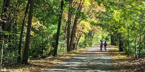
The Minuteman Bikeway passes through the historic area where the American Revolution began in April 1775. Built by Massachusetts on an inactive railroad, the trail is used by local residents as a convenient, eco-friendly way for commuters to reach train stations. The path is 12 feet wide, plowed in the winter time, and includes lots of stops for refreshments and restrooms at Depot Park in Bedford, the Lexington Visitor’s Center, Alewife Station, and business districts along the bikeway. Trail access in Bedford is available at the intersection of South Road and Loomis Street (exit 31B from I-95); at Lexington Center and Arlington Center, and at the Alewife T-Station. - Trail Map
Chesterfield, MA
Chesterfield Gorge
River Road 413-532-1631Mountain biking is allowed on the Chesterfield Gorge property, but only on River Road (also called East Branch Trail). Bikers can get access to this road / trail from the parking lot. See a full description on our Wal;king & Hiking page, with information on hours, admission, what to see and do.
Jamaica Plain, MA
Arnold Arboretum
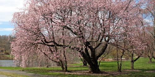
125 Arborway 617-524-1718This 125-year-old Boston city park and Harvard research center was designed by Frederick Law Olmsted and has a wonderful set of paved roads that are mostly closed to motorized traffic. Peters Hill, on which you now have to walk the last 200 feet to the summit, provides the best grounded view of Boston from within its boundaries. Trail Map (PDF)