Walking and Hiking
Cape Cod & the Islands have woods and beach places to walk
18 listings
Mashpee, MA
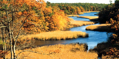
Mashpee River Reservation
Quinaquisset Avenue and Meetinghouse Road 508-679-2115Two miles of trails wind through Mashpee River Reservation to a pristine shoreline. The reservation's trails link with the Cape Cod Pathways trail system.
West Tisbury (on the island of Martha's Vineyard), MA
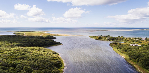
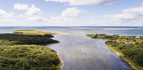
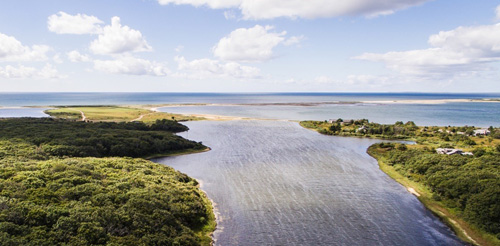
Long Point Wildlife Refuge
Off Long Point Road 508-693-7662Long Point covers 600 acres of beaches, dune, and woodland. Outside the summer season, birders and other nature-watchers also enjoy exploring the property and its easy-walking trails. A two-mile trail that leads through oak forest and grasslands.
See full description of property , including hours and admission, at our Science & Nature page.
Martha’s Vineyard, MA
Menemsha Hills
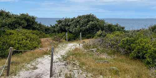
North Road, Chilmark 508-693-3678Prospect Hill is the second-highest elevation on Martha’s Vineyard. It has three miles of trails through wetlands, woodlands, coastal plain, and a rocky seashore. Views from the heights are magnificent. Open year-round, daily, sunrise to sunset. Allow a minimum of 90 minutes to walk.
Directions: Starting from State Road in West Tisbury, turn right onto North Road heading westerly toward Chilmark and follow for five miles. Entrance, with parking spaces, is just past Tabor House Road, at right.
Vineyard Haven, MA
Cedar Tree Neck Wildlife Sanctuary
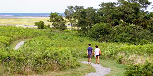
Indian Hill Road 508-693-5207This preserve along the Martha's Vineyard north shore features several trails with numerous scenic views.
Chatham to Provincetown, MA
Cape Cod National Seashore
Various Locations 508-255-3421Visitors to the Cape Cod National Seashore may walk on the many hiking trails in the park, and also may walk on the bike trails.
Popular Trails: Fort Hill Trail (Eastham) - Nauset Marsh Trail (Eastham) - Doane Trail (Eastham) - Atlantic White Cedar Swamp Trail (Wellfleet) - Great Island Trail (Wellfleet) - Beech Forest Trail (Provincetown)
Edgartown, MA
Felix Neck Wildlife Sanctuary
100 Felix Neck Drive 508-627-4850Vistors to this nature center will find plenty of self-guided trails, as well as live native birds. Of particular interest are ospreys nesting in their natural environment. There is an admission fee. - Trail Info
Waquoit (East Falmouth), MA
Trails of the Waquoit National Estuarine Reserve
131 Waquoit Highway 508-457-0495The reserve has marked walking trails at the Reserve Headquarters, the Quashnet River area, South Cape Beach State Park, Abigail’s Brook, and Washburn Island (see map ). Note that dogs are not permitted on any beaches from April 1 to September 1. When and where dogs are permitted, they must always remain on leash. Directions to the Reserve.
Visitor Center/Headquarters Map & Trail Map .
Falmouth, MA
Beebe Woods via Highfield Hall
56 Highfield Drive 508-495-1878Named after the Beebe Family that created the Highfield estate, Beebe Woods consists of 383 acres of land given to the Town of Falmouth in 1972. The woods were once part of the 700-acre property owned in the 1870s by James Madison Beebe. Beebe Woods has an extensive network of walking trails over varied terrain, exploring wooded ridges and steep-sided hollows, and he picturesque pond known as the Punch Bowl.
The trails connect at the southern end of Beebe Woods to Peterson Farm. The Beebe Woods Trailhead can be reached via Highfield Hall. Park at Highfield Hall and enter the property at the Ice House.
Provincetown, MA
Dune Shacks Trail
Route 6 North near Snail RoadThe trailhead is off Route 6 at Snail Road in Provincetown. There is a small parking area. You will be walking northward, away from the village of Provincetown, toward the ocean and away from Cape Cod Bay. You are walking through dune grass and parabolic sand dunes. Views of the dunes, ocean, and dune shacks are stunning. Bring water. Do not flip flops; the sand is very hot. Bring sunscreen. Walk to the shore takes about 45 minutes.
Parking: Trail head and parking on Route 6 North at Snail Road
Dennis, Harwich, Brewster, Orleans, Eastham, and Wellfleet, MA
Cape Cod Rail Trail
508-896-3491The Cape Cod Rail Trail follows a former railroad bed for 22 miles through the towns of Dennis, Harwich, Brewster, Orleans, Eastham and Wellfleet. Its paved surface, few hills, and well-marked automobile crossings make it ideal for cyclists. The trail has a wide unpaved shoulder on one side to accommodate horseback riding, walkers, and runners.
There are many opportunities to get off the trail and visit a beach. Food and water are available and public restrooms can be found at Nickerson State Park, Salt Pond Visitors Center at Cape Cod National Seashore and the National Seashore Headquarters. Bike rentals are available at many points along the way.
See trail website for list of free parking lots. Trail Map
East Sandwich, MA
Green Briar Nature Center and Thornton W. Burgess Society
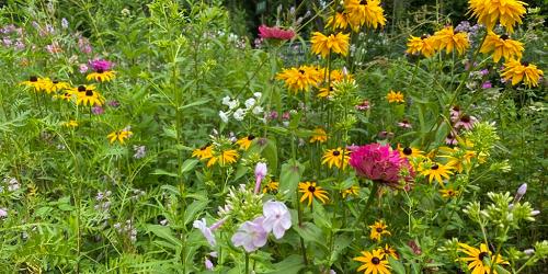
6 Discovery Hill Road 508-888-6870Located on the shores of Smiling Pool, this center celebrates with animal stories by Thornton Burgess, an enormously popular children’s writer of the early 20th century. Adjacent to Green Briar is the 57-acre Briar Patch Conservation Area, home of Peter Rabbit and many of the other Thornton Burgess animal characters.
Natural history programs for children and adults are offered year-round and include classes, field trips, guided walks, and workshops on the natural sciences. There are wonderful nature trails and a spectacular wildflower garden to explore. Walking trails are open to the public.
South Wellfleet, MA
Wellfleet Bay Wildlife Sanctuary
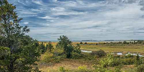
291 US Route 6 at West Road 508-349-2615This nature center offers a variety of educational programs for children and adults, including walks and workshops. Enjoy a naturalist-led bird walk on our property or listen to an evening lecture. This sanctuary has a nature center, walking trails, trail to Goose Pond, seasonal classroom, gardens, and a campground. Picnicking, birdwatching, restrooms, wheelchair accessible. Of particular interest is the boardwalk trail through the salt marsh. - Trail Info & Map
Edgartown, MA
Cape Poge Wildlife Refuge, Wasque Reservation, East Beach
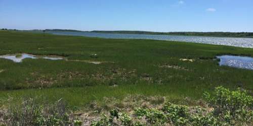
Dike Road - on Chappaquiddick Island 508-627-7689Fourteen miles of trails for hikers and over sand vehicles through marsh meadows and on sandy barrier beaches. Wildlife and coastal scenery. Island can be reached only by boat or ferry out of Edgartown. - Trail Map (PDF)
MA
Cape Cod National Seashore Bike Trails
508-771-2144Cape Cod has very extensive biking trails, which also are used for walking. See a full description on our Biking page.
Edgartown (on Martha's Vineyard), MA
Norton Point
end of Katama Road 508-627-7689This 2.5-mile-long strip of sand and dunes linked Martha's Vineyard and the island of Chappaquiddick until 2007, when a storm breached in the barrier beach. There are 2 miles of over sand-vehicle trails and 4.5 miles of walking trails and sandy roads in the upland area.
Open year-round, daily. Dogs must be kept on a leash. Free for pedestrians. Oversand vehicle (OSV) permits are required.
Wauwinet (on the island of Nantucket), MA
Coskata-Coatue Wildlife Refuge
Wauwinet Road 508-228-5646Coskata-Coatue Wildlife Refuge is known for its historic lighthouse, white sand beaches, and world-class fishing. Rolling maritime dunes cover more than 200 acres. Refuge includes 16 miles of over-sand vehicle and walking trails and beach front. Gray and harbor seals feed in the Great Point riptide. Facilities include public restrooms between the Wauwinet Gatehouse and Great Point Lighthouse and at the lighthouse. Both are open May 1 to October 31. Bike rack at the Wauwinet Gatehouse. Seasonal tours of the Great Point Lighthouse and the natural wonders of the refuge. Hours: Year-round, daily, 24 hours (10 p.m.-5 a.m. - fishing access only). Cost: Free to all pedestrians and boaters.
Edgartown, MA
Manuel Correllus State Forest
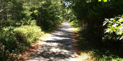
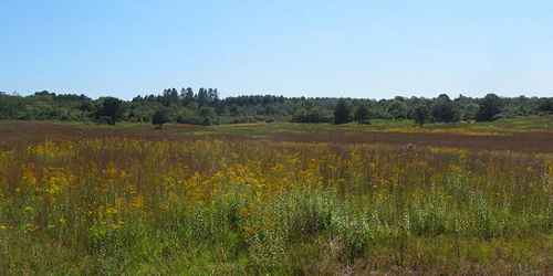
Barnes Road 508-693-2540Fifteen miles of trails through this interesting preserve of many island ecosystems. - Trail Map (PDF)
Mashpee, MA
Lowell Holly
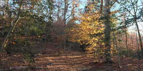
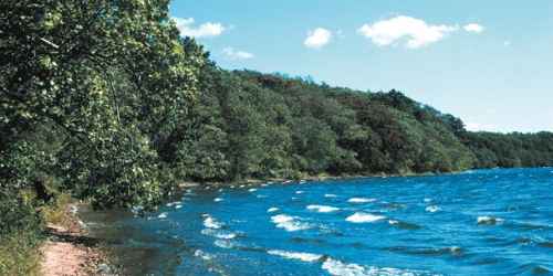
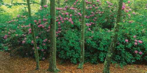
South Sandwich Road 508-636-4693Four miles of foot trails and old carriage roads offer walking of moderate difficulty among groves of holly and rhododendron. Views of freshwater ponds.